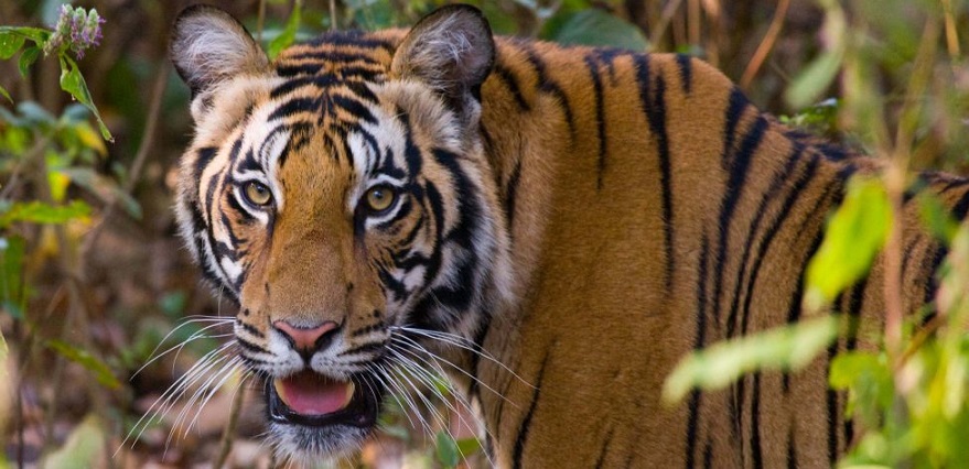
One of the most popular national parks in Madhya Pradesh is the Bandhavgarh National Park with the status of sheltering the highest density of Royal Bengal Tigers. Apart from this, interestingly, Bandhavgarh is also a legendary place that has flourished through various significant historical legends and places along with its distinctive geographical features and topography.
The Blog will reveal some enticing historical and geographical facts about Bandhavgarh National Parkthat you must know and will find interesting!
Bandhavgarh’s Historical Antiquity
The Word ‘Bandhav’ means Brother and ‘Garh’ means Fort which together means Brother’s Fort. As, during ancient times, Lord Rama gifted this phenomenal fort to his younger brother, Lakshman. The Place is associated with Ramayana as one can learn through the ancient books of Narad Panch Ratra and Shiv Purana. The Fort is scripted with various convincing evidences of human activities and architecture along with several man-made caves with inscriptions and rock paintings. And, the ruined fort which was later reconstructed by two monkeys who built the bridge between Lanka and the mainland.
The Bandhavgarh Fort has been discovered to be a great masterpiece of “Treta Yuga” dating before the Christ period through archaeological surveys.
Also, the written proofs of the Bharihas and Vakatak Dynasties who ruled over the land in and around the Bandhavgarh region is a must visit for tourists visiting Bandhavgarh National Park as it unveils the history of the major rulers who ruled the Bandhavgarh region like the Baghels, Kalchuris, and Sengars. Among them, Baghels were believed to rule the region for a longer period of time.
No wonder the place was also the popular hunting ground for the Maharajas of Rewa but later, they handed over the land to the State Government, and in the year 1968, the royal place was declared a National Park.
With this, the Bandhavgarh National Park was declared a tiger reserve in the year 1993 under the Project Tiger network at the neighbouring Panpatha Sanctuary.
Bandhavgarh’s Distinctive Geography
Situated on the North Eastern Border of Madhya Pradesh in the Central Part of India, the Bandhavgarh National Park dwells around UmariaShahdol district bounded by the Satpura Mountain Ranges with geographical coordinates 23°30’ to 23°46’ N and 80° 11’ to 36°E. The National Park is elevated at an altitude between 410 and 810 m. with favourable temperatures during winters between 0° to 20° C and during summers 36°C to 46°C. The BandhavgarhTala Mountain Ranges are composed of sandstone with a soil composition of sandy to sandy loamy. The Bandhavgarh Region comprise of 20 streams some of the important streams are Johilla, Charanganga, Damnar, Janadh, Ambanala, Banbei, and AndhiyariJhiria. These streams will further merge into the Son river which is an important Southern Tributary of River Ganga.
In the vicinity and around the Bandhavgarh National Park various caves and lakes are also found especially around the Bandhavgarh Fort which is the most splendid and primeval part of Bandhavgarh.
Thus, Bandhavgarh National Park with its enticing historical and geographical facts makes ita must visit place with a good dose of adventurous and knowledgeable travel.
